TinyLEO

Small-scale LEO Satellite Networking for Global-scale Demands

Abstract

Do we really need tens of thousands of Low Earth Orbit (LEO) satellites to meet the world's massive Internet demand? While LEO mega-constellations have proven technically feasible and commercially valuable, they raise serious concerns about prohibitive capital expenditures, market monopolization, and the unsustainable use of orbital space. Our analysis reveals that a large fraction of these satellites may be wasted due to mismatches between physical supply and uneven global demand. To address this, we propose TinyLEO—a software-defined solution to dynamically match spatiotemporal demand with minimal satellite supply. TinyLEO sparsifies the satellite network on demand by combining diverse yet sparse orbital configurations. It hides the operational complexity of this sparse LEO network via orbital model predictive control, and shifts the burden of managing that complexity to a geographic segment anycast system. This leads to higher usability, lower resource waste, faster failovers, simpler satellites, and more flexible orchestration. We prototype TinyLEO as an open-source community toolkit for further research. Our evaluation shows that TinyLEO can shrink current LEO mega-constellations by 2.0–7.9× and reduce control-plane costs by 1–3 orders of magnitude, all while maintaining comparable data-plane performance.

Results

On-demand LEO Network Sparsification

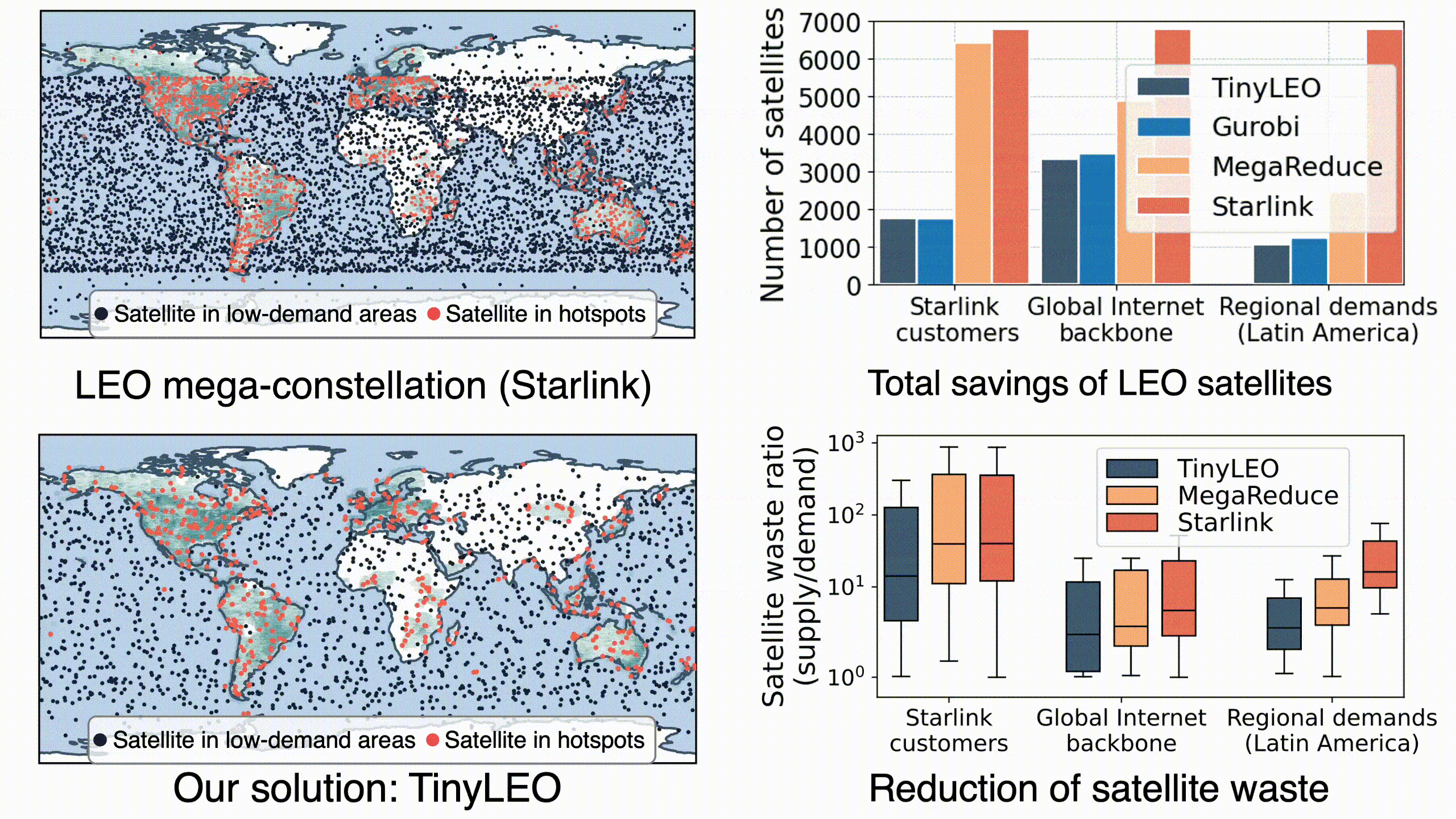
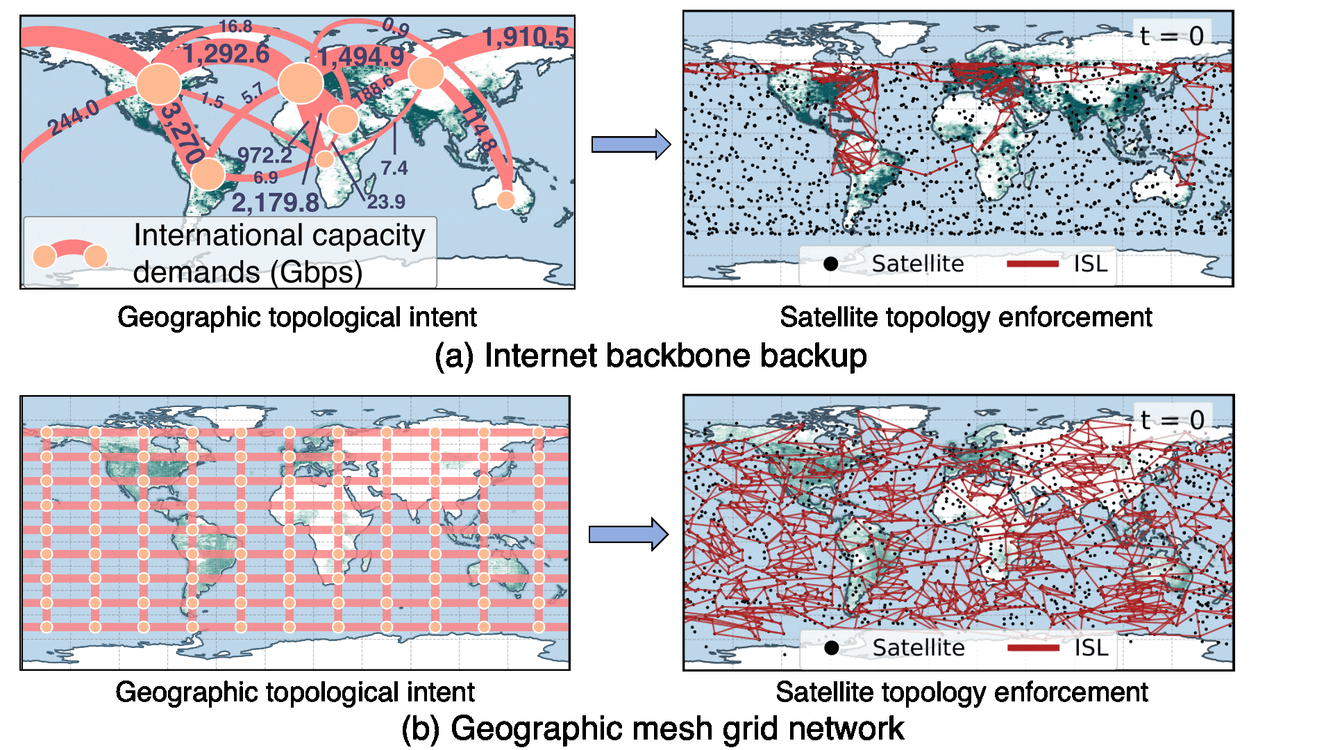
TinyLEO combines diverse yet sparse Earth-repeat orbits to cut satellite redundancy over space and time (akin to video compression). It can compress the existing LEO satellite mega-constellation network size by 2.0–7.9×, while meeting the same broadband demands.

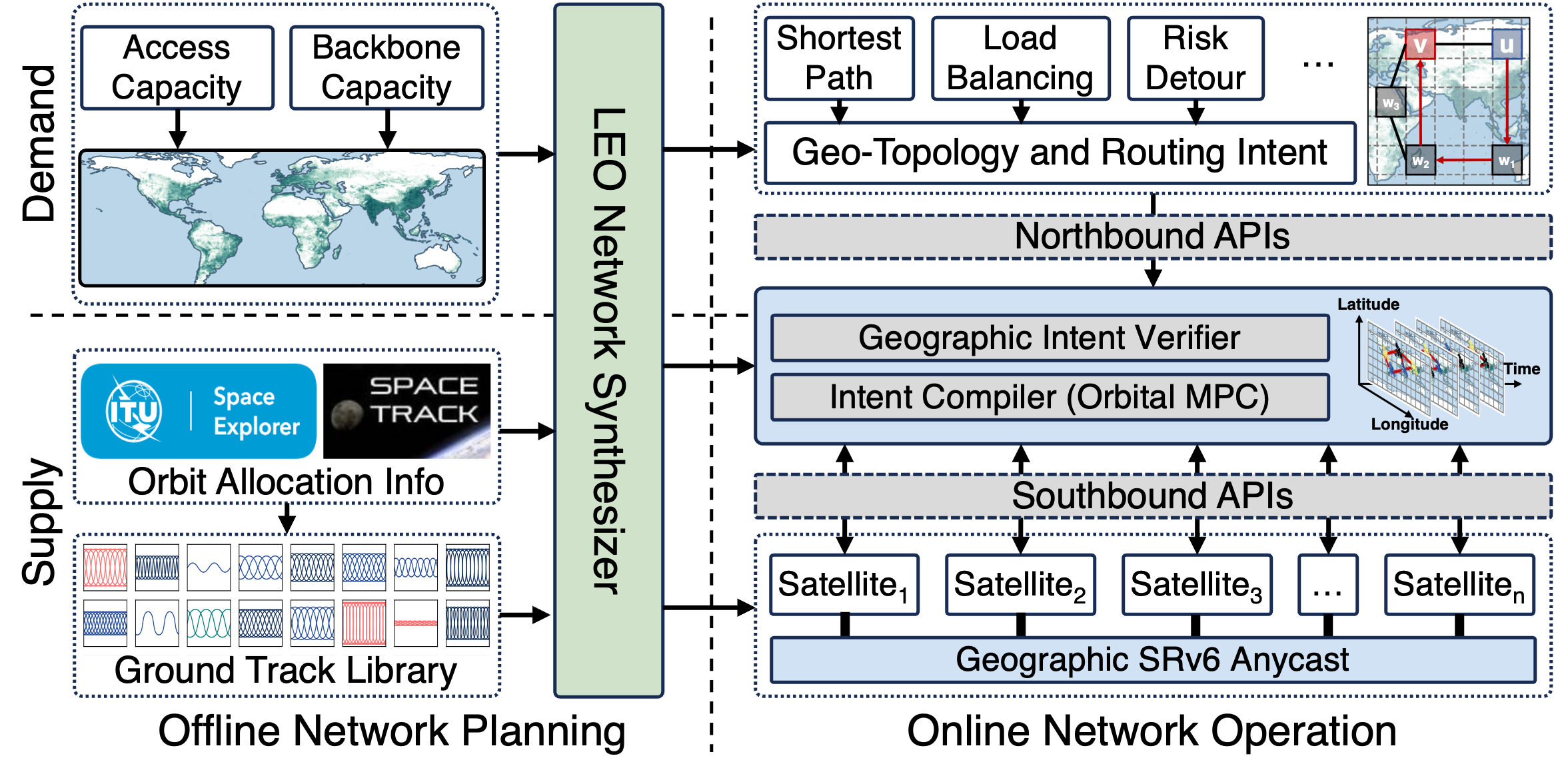
Control Plane: Stable Intent + Orbital MPC

TinyLEO stabilizes high-level networking intents (demands) by satellite-independent geography and decouples them from their low-level dynamic enforcements (supplies). This avoids frequent geographic route updates under LEO dynamics, saving signaling costs by 1–3 orders of magnitude.

Data Plane: Geographic Segment Anycast

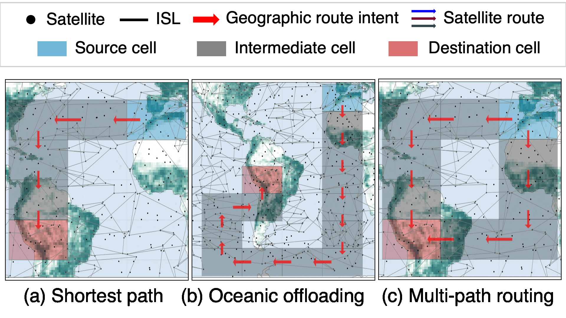
TinyLEO shifts the responsibility of handling the complex LEO network dynamics to data plane. Its near-stateless geographic segment anycast can enforce flexible, policy-compliant local (re)routing, load balancing, and fast recovery from failures (e.g., by solar storms and satellite link disruption).

Paper

TinyLEO Community Toolkit

TinyLEO is designed as an affordable, sustainable satellite network solution for small ISPs and countries. To achieve this goal and foster more community efforts in this direction, we have implemented all features in TinyLEO as a complete community toolkit for open research and experiments. Our community toolkit distinguishes itself from recent LEO network simulators since it not only supports packet-level data-plane tests, but also of- fers upstream LEO network planning and control-plane features. It also departs from current commercial TS-SDN controllers by offering geographic networking intent APIs and open-source or- bital MPC-based control logic. This toolkit can be used to synthesize sparse LEO networks on demand, specify high-level networking intents by geography, enforce these intents at runtime with orbital MPC, and conduct per-packet emulations with hardware in the loop (see TinyLEO-toolkit for details).

BibTeX

@inproceedings{tinyleo,
  author  = {Li, Yuanjie and Chen, Yimei and Yang, Jiabo and Zhang, Jinyao and Sun, Bowen and Liu, Lixin and Li, Hewu and Wu, Jianping and Lai, Zeqi and Wu, Qian and Liu, Jun},
  title   = {Small-scale LEO Satellite Networking for Global-scale Demands},
  booktitle={Proceedings of the ACM SIGCOMM 2025 Conference},
  year    = {2025},
}